
Technical Guide
The Process of Subdividing a Parcel in British Columbia
Professional insight into municipal regulations, survey requirements, and title registration.
The process of subdividing a parcel in British Columbia sits at the intersection of various municipal and provincial regulations and approvals. In general terms, it involves creating one or more new lots from one or more existing lots through the registration of plans by establishing good safe holding and marketable title in fee simple for each of the new lots.
These conditions are essential for ensuring the new lots are free from undisclosed defects, and safe from future legal challenges, such that they can easily be sold to others.
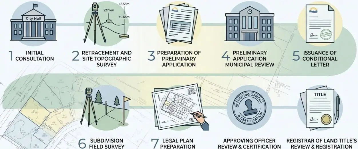
While the process itself varies depending on the municipality the lots are situated within, it can generally be summarized as follows:
1. Initial consultation with Municipality to assess feasibility
What is the first step when considering subdividing a parcel in British Columbia?
The applicant, along with the BC Land Surveyor supporting the work, contacts the municipal planning department to assess the feasibility of proceeding with the subdivision.
Points of discussion include:
- Zoning Bylaws
- Minimum Lot Size + Dimensions
- Trees
- Steep slopes and Geotechnical Considerations
- Proximity to watercourses
- Lot Servicing Requirements
- Access Requirements
- Park Dedication Requirements
2. Retracement and site survey of Subject Lot(s)
What surveys are required for a preliminary subdivision application in BC?
A preliminary survey is conducted to collect all the relevant information required to prepare the preliminary application to subdivide. The survey requirements can be split into two categories:
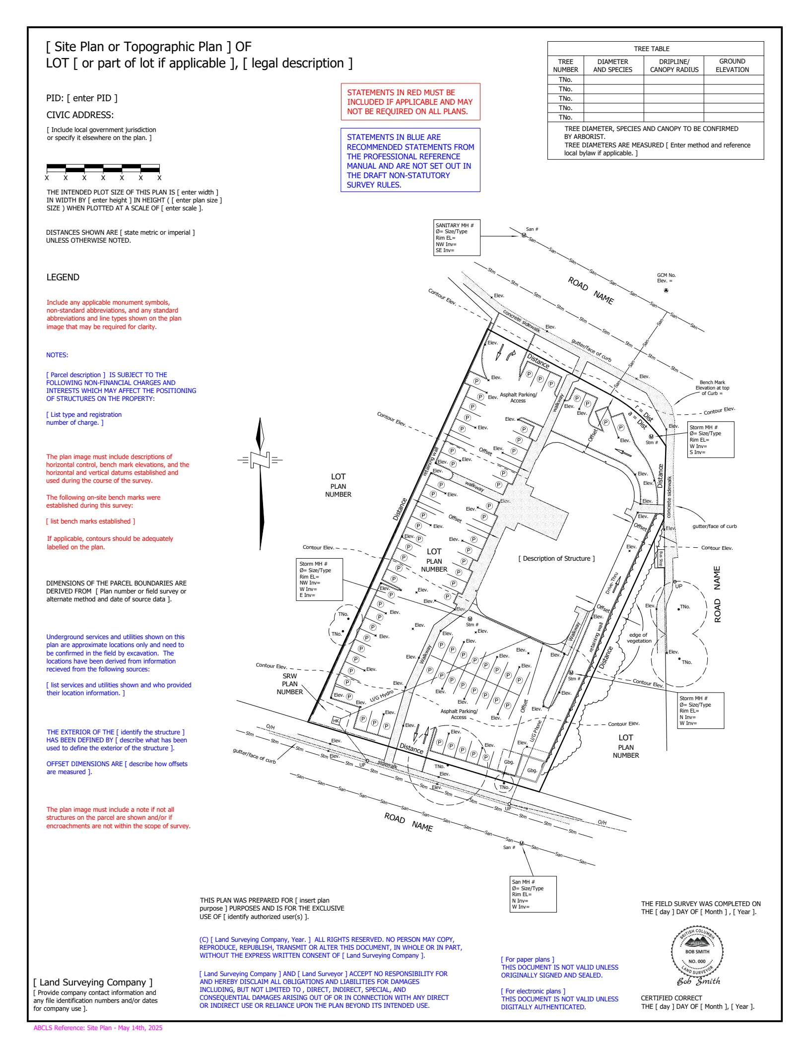
A. The Topographic Survey
The topographic survey per the municipal submission requirements. These requirements are essential for the various municipal departments (e.g. engineering, planning, building) to complete their assessments as they determine whether they can permit the lot(s) to be subdivided. The topographic survey requirements vary by municipality, however they typically include:
- Existing building locations with setbacks and dimensions
- Location and diameter (DBH) of any significant trees on site
- Current site access (e.g. roads, driveways, etc…)
- Grade changes and Steep slopes
- Watercourses/Ravines/Natural Boundaries
- Above ground services
- Sewer locations and inverts
- Adjacent lot buildings
- Grades at Lot corners and adjacent lots (~5m offset)
B. The Boundary Retracement Survey
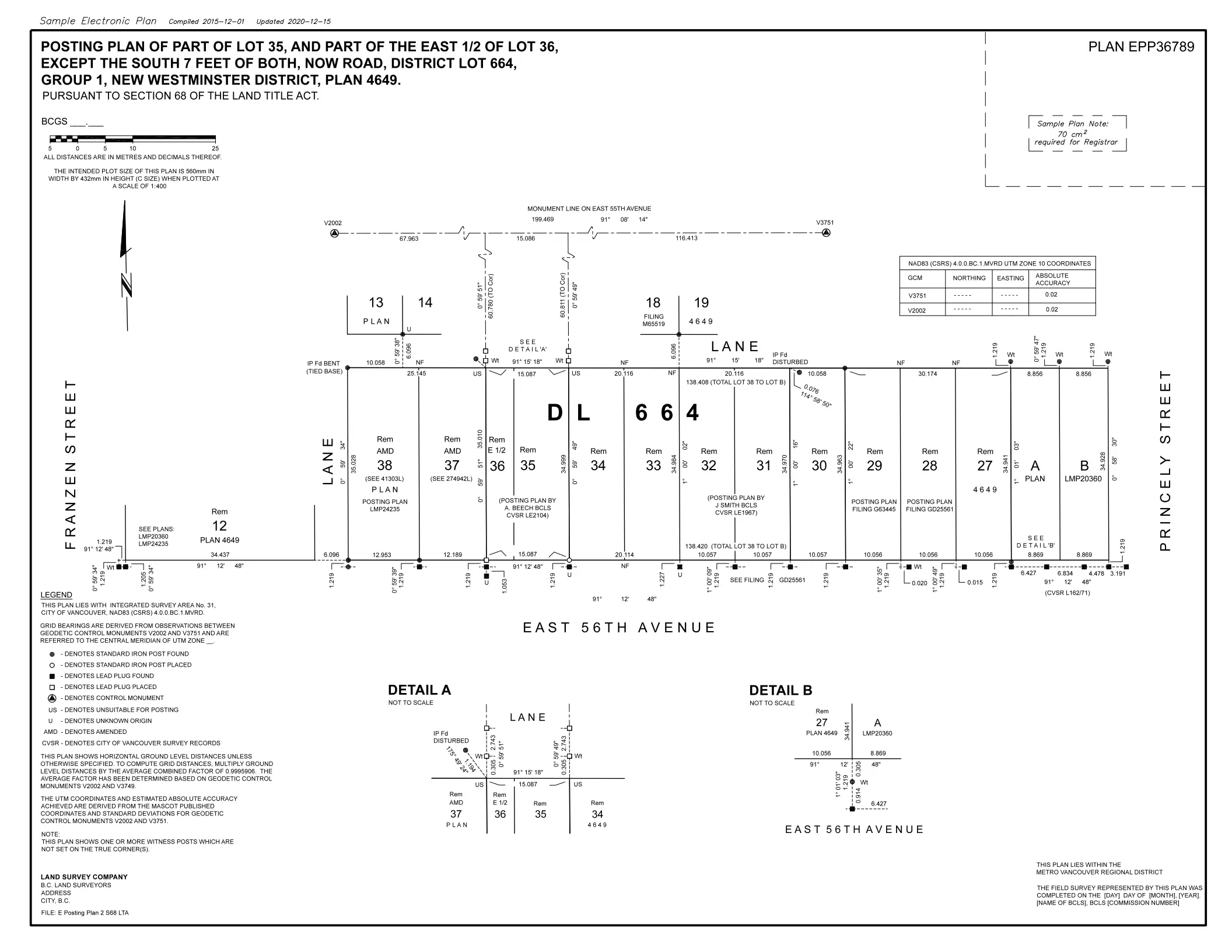
A boundary retracement survey that re-establishes the original boundaries of the subject lot(s) that are proposed to be subdivided. This is required to produce a proposed subdivision plan that depicts the proposed dimensions and lot areas of the parcels resulting from the subdivision.
3. Preparation of a preliminary application to subdivide
What documents are included in a preliminary application to subdivide in BC?
A preliminary application to subdivide is prepared and submitted to the municipality that includes:
- Topographic Plan of the Subject Lot(s).
- Current Title Search
- Copies of any existing charges, liens or notices on the titles of the lot(s) proposed to be subdivided.
- The proposed subdivision plan depicting: Property Dimensions of the Subject Lot, and Dimensions and Areas of the Proposed Lots.
Other applications, such as Development Variance Permits, Development Permits and Re-zoning may also be required. The requirements for subdivision applications vary by municipality.
4. Preliminary Application Municipal Review
Who reviews the preliminary subdivision application at the municipal level?
The preliminary application is reviewed by the municipal approving officer, the planning department, the engineering department, and any other department deemed necessary.
The approving officer must consider a wide range of factors when reviewing a preliminary subdivision application, such as:
- Proposed road access to the subdivision.
- Proposed land use of the subdivision.
- Proposed shape and size of the subdivided parcels.
- Adverse physical effects the proposed subdivision may have on adjacent lots.
- Utility servicing to the proposed lots.
- Lands required for proposed parks and proposed municipal roads.
- Development cost charges associated with the proposed subdivision.
- Amenity cost charges associated with the proposed subdivision.
- Approvals from other government agencies.
5. Issuance of a Conditional Letter
What is a conditional letter in the BC subdivision process?
If the approving officer gives tentative approval, a letter outlining the conditions of the subdivision is issued.
The conditions may include:
- Registration of Charges on title (i.e. Restrictive Covenants, Easements, Rights of Way) and the Preparation of Charge Plans for registration in the Land Title Office.
- Park Dedications and the preparation of Park Dedication Plans for registration in the Land Title Office.
- Road Dedications and the preparation of Road Dedication Plans for registration in the Land Title Office.
- Road Closures and the preparation of Road Closure Plans for registration in the Land Title Office.
- Development and amenity cost charges.
- Utility Servicing Agreements.
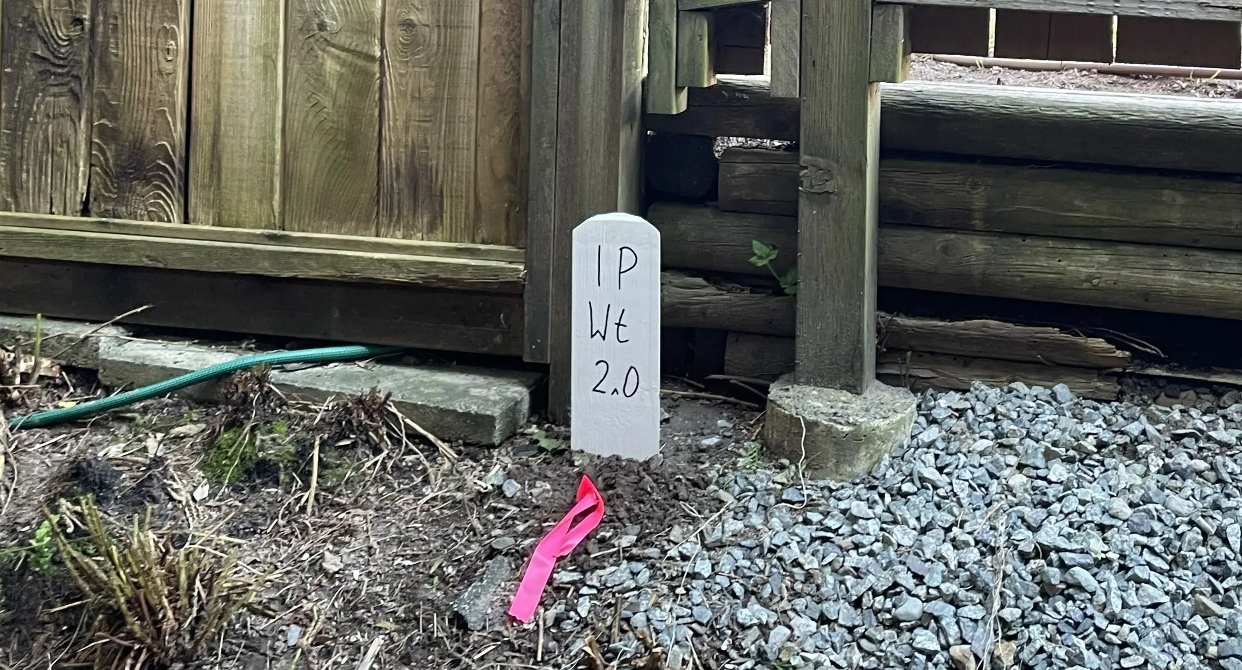
6. Subdivision Field Survey
What does a subdivision field survey entail?
A field survey is conducted that consists of setting new legal survey monuments at every corner and point of curvature that defines:
- The extent of each subdivided lot.
- The extent of each road dedication.
- The extent of each park dedication.
- The extent of all charges (unless an explanatory plan is acceptable).
7. Legal Plan Preparation
What factors influence the preparation of legal plans for a subdivision in BC?
Following the field survey, the required plans are prepared for registration in the Land Title Office. The preparation of plans is influenced by the following factors:
- Is a municipal approving officer required to certify the plan?
- Are the extent of charges defined by a reference plan or an explanatory plan?
- Can multiple plans (e.g. subdivision and road dedication) be combined into a single subdivision plan?
The following table explains the factors that influence the preparation of plans:
| Type of Plan | LTA Section | Approving Officer Certification? | Combined with Subdivision Plan? | Field Survey Required? |
|---|---|---|---|---|
| Subdivision Plan | 67 | Yes | Not Applicable | Yes |
| Consolidation Plan | 100 (1) (b) | No | Yes | Yes |
| Road Dedication Plan | 107 | Yes | Yes | Yes |
| Park Dedication Plan | 107 | Yes | Yes | Yes |
| Reference Plan for Easement | 99 (1) (e) | No | No | Yes |
| Reference Plan for Covenant | 99 (1) (e) | No | No | Yes |
| Statutory Right of Way Plan | 113 | No | No | Yes |
| Explanatory Plan for Easement | 99 (1) (e) | No | No | No |
| Explanatory Plan for Covenant | 99 (1) (e) | No | No | No |
| Explanatory Plan of SRW | 99 (1) (e) | No | No | No |
8. Approving Officer Review and Certification
What is the role of the municipal approving officer before title registration?
All plans, including those not requiring the approving officer’s certification, are submitted to the approving officer for review to demonstrate satisfying the requirements to subdivide outlined in the conditional letter issued by the municipality.
Once all conditions required to proceed with subdivision have been met, the approving officer certifies the plans as necessary.
9. Registrar of Land Title’s Review and Registration of Titles
How are new titles registered following a subdivision in BC?
The proponent coordinates with the approving officer, the BC Land Surveyor and their legal representation to submit the plans to the Land Title Office. The registrar of land titles reviews the subdivision application, including all plans and documents prepared on behalf of the proponent.
Once the registrar is satisfied that the boundaries of the lands are sufficiently defined by the description in submitted plans and documents, and that good safe holding and marketable title in fee simple has been established by the proponent, titles to the new lots are registered in the land title Register.
10. Additional Considerations
What additional factors can introduce complexity to a BC subdivision?
There are several important considerations that can introduce significant complexity to the subdivision process described above, such as:
- Is the lot within an agricultural land reserve (ALR)?
- Does the lot have a natural boundary?
- Does the lot currently have road access?
- Was the lot previously used for a commercial or industrial purpose that falls under the contaminated sites regulations?
Ready to Begin Your Project?
Contact Tantalus Geomatics to discuss the feasibility and survey requirements for your property subdivision.