Road Surveys in the Sea to Sky
Professional Road Surveys in the the Sea to Sky, establishing alignment controls, horizontal curves, and geometric layout tracking for structural access roads or highway corridors.
Whether designing new transportation infrastructure, dedicating public access for a major municipal subdivision, or resolving historical access rights in the Sea to Sky, the establishment and surveying of roads is an intensely regulated legal process. Navigating the complex spatial and legislative requirements demands professional geomatics engineering, strategic foresight, and high statutory authority. In British Columbia, the measurement of land to determine, locate, define, establish, or re-establish boundaries is legally defined as the "practice of land surveying" under the Land Surveyors Act. Therefore, only a commissioned British Columbia Land Surveyor (BCLS) holds the exclusive statutory right to determine the legal boundaries of transportation corridors and certify the associated survey plans.
The classification and creation of road corridors are governed by overlapping provincial statutes. Under Section 1 of the Land Act, a "public road" is defined as a portion of Crown land designated or indicated as a road on a plan of survey made under the Act, including road and walkway allowances. Conversely, a "highway" is defined under Section 1 of the Transportation Act and encompasses public streets, roads, trails, lanes, and bridges. Highways can be legally established through several mechanisms: the deposit of a subdivision, reference, or explanatory plan under Section 107 of the Land Title Act; the expenditure of public money under Section 42 of the Transportation Act; a common law dedication; a historical Gazette Notice; or by being depicted in a specific colour on a Crown grant tracing.
To conduct these specialized surveys, our professionals must adhere to Part 6 of the Association of British Columbia Land Surveyors (ABCLS) Survey and Plan Rules, which governs highway, public road, and railway surveys. For highway surveys exceeding one kilometre in length, our crews must deploy highly specific monumentation frameworks, utilizing either a boundary system or a centre line system to systematically mark the corridor. Furthermore, the intersections of the new highway with existing surveyed boundaries, water bodies, and other travelled ways must be rigorously determined and documented.
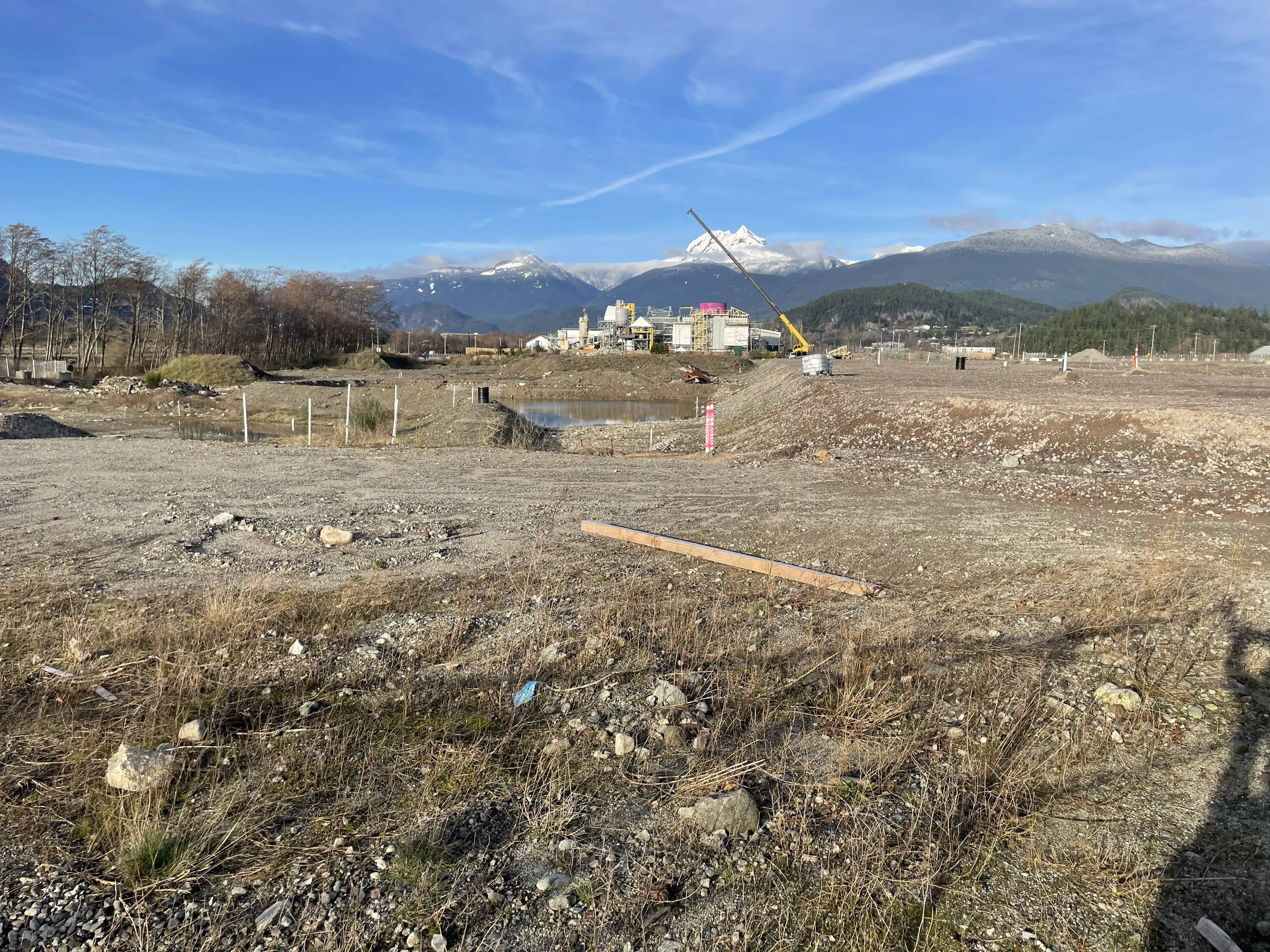
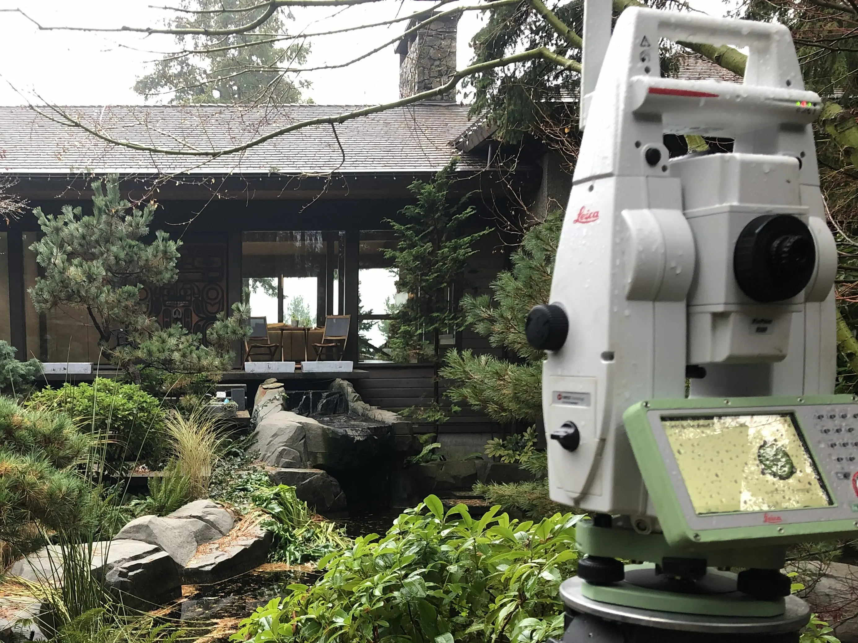
To capture the complex topography and boundary evidence associated with road surveys in the Sea to Sky with high absolute and relative accuracy, our firm deploys an professional arsenal of cutting-edge geomatics equipment. During the preliminary route planning and reconnaissance phases, we utilize Aerial Drone Photogrammetry and Aerial Drone LiDAR to penetrate dense vegetation and generate accurate 3D topographic terrain models. We establish a highly robust primary survey control network by occupying points for extended durations using Static GNSS Receivers, integrating the corridor seamlessly into the provincial active control system. From this primary network, our survey crews utilize RTK GNSS measurements to rapidly navigate the site and capture boundary evidence with centimeter precision in open-sky environments. However, in dense urban corridors, deep ravines, or under heavy tree canopy where satellite signals are obstructed, we deploy high-precision Robotic Total Stations to run closed-loop traverses, ensuring absolute statutory compliance. When a road corridor involves intricate infrastructure, bridges, or complex retaining walls, Terrestrial LiDAR (3D laser scanning) is utilized to capture a high-density 3D point cloud of the as-built conditions, guaranteeing that all physical elements are accurately mapped relative to the legal boundaries.
Why Choose Tantalus Geomatics?
Our team combines local the Sea to Sky expertise with state-of-the-art surveying technology. We deliver highly accurate, BCLS-certified plans that streamline your municipal permit approvals and protect your property investments.
Our Road Surveys Process in the Sea to Sky
How do we ensure accuracy and efficiency in our land surveying projects?
Research
The foundation of a road survey is documentary research and design consultation. The BCLS accesses the Land Title and Survey Authority of British Columbia (LTSA) to retrieve current Certificates of Title, historical subdivision plans, original Crown grants, and surveyor field notes. Because roads can be established through unconventional means, the BCLS must also research the Ministry of Transportation and Infrastructure (MoTI) Road Registers, historical Gazette notices, and court orders. This systematic research phase ensures that the BCLS fully understands the legal origins of the corridor before our crews arrive on site in the the Sea to Sky.
Field Work
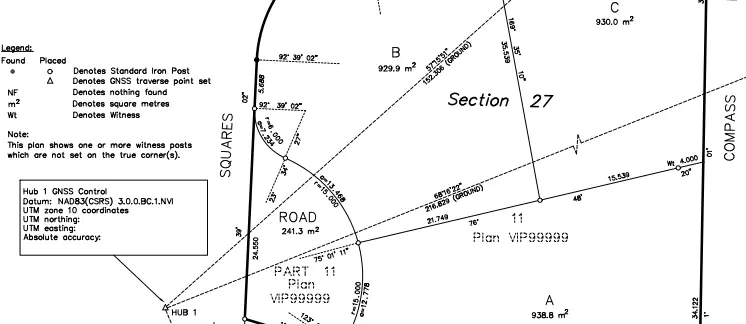
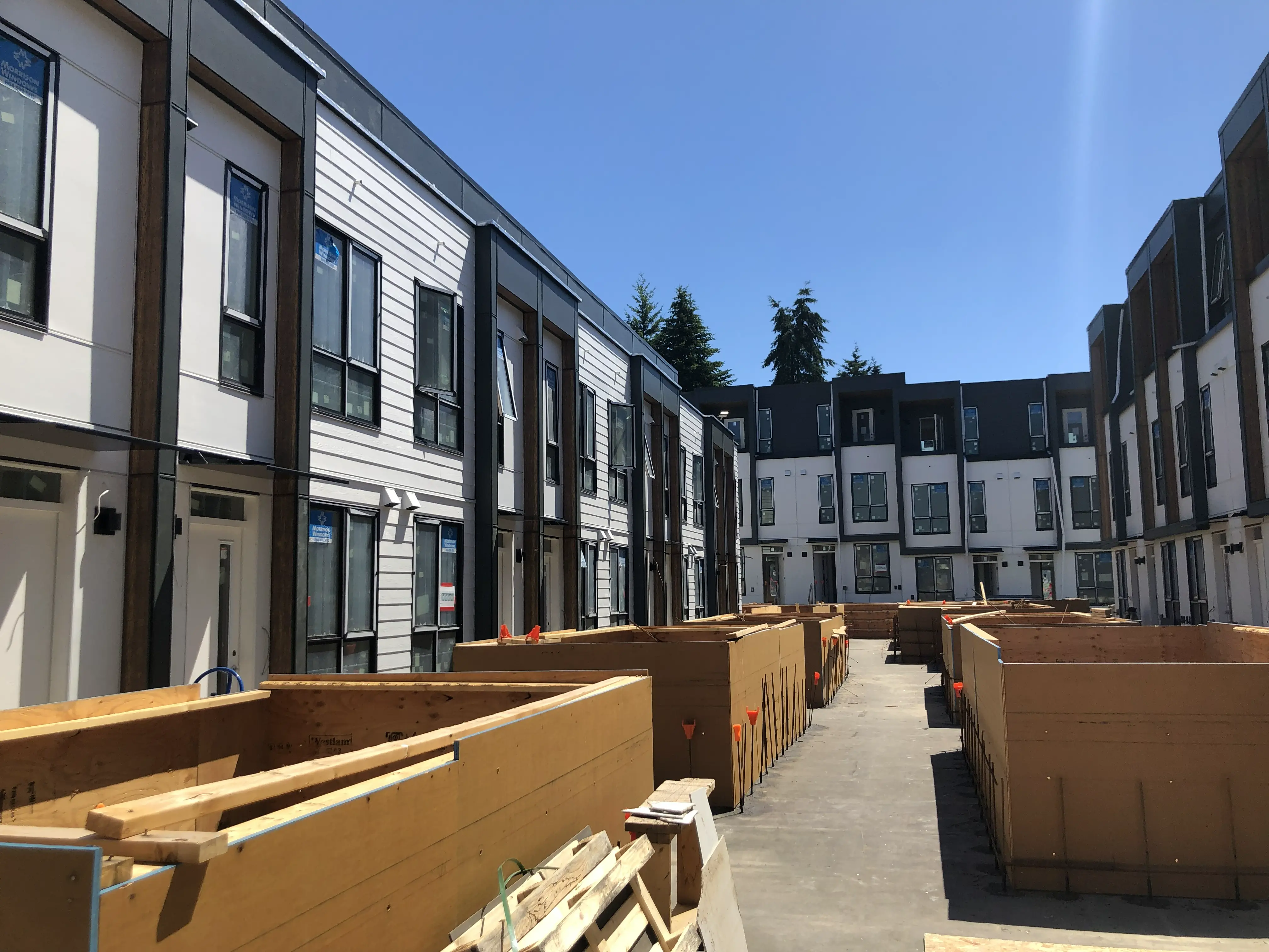
Before the road corridor can be legally defined, the intersected parent parcel boundaries must be rigorously re-established on the ground. The ruggedness of the terrain, the density of the vegetation, and the requirement for active traffic management directly impact the scope of the field work and the time required to complete the survey. Utilizing RTK GNSS Receivers and Robotic Total Stations, our survey crews place durable standard iron posts (Type 1, 2, 4, or 5 monuments). Under the boundary system mandated by the ABCLS Survey and Plan Rules, posts are set at the start and end of the survey, at points of curve or deflection, and at intermediate points so that the distance between posts does not exceed 1 kilometre. The BCLS legally adjudicates the true boundary lines by applying the common law hierarchy of evidence to secure the physical limits of the corridor.
Plan Preparation
Our drafting technicians translate the precise 3D field data into a highly regulated statutory plan, such as a Reference Plan under Section 107 of the Land Title Act or a plan under the Land Act. In strict accordance with the Survey and Plan Rules, the plan must detail the perpendicular width of the highway at frequent intervals, the values of convergence, the serial numbers stamped on the monuments, and a comprehensive book of reference listing the legal descriptions of all parcels crossed. As your certifying professional, the BCLS electronically signs the Survey Plan Certification (SPC) using a secure digital certificate. The certified plan is then submitted to the Surveyor General for approval or to the Land Title Office for registration, legally dedicating the highway to the public.
What professional documents and markers do you receive upon project completion?
What professional documents and markers do you receive upon project completion?
Certified Legal Plans
Digitally certified PDF Reference Plans, Subdivision Plans, or Crown Land Plans, fully compliant with LTSA and Surveyor General standards, ready for legal deposit to dedicate or define the road.
Property Corner Monumentation
Standard iron posts, lead plugs, or capped concrete posts securely set in the ground to permanently mark the boundaries, curves, and deflections of the highway corridor.
Topographic 3D CAD Files
digital drafting files (DWG/DXF) mapping the road boundaries, existing infrastructure, and site topography for integration by your civil engineers and design teams.
Point Clouds and Orthoimages
Dense 3D Terrestrial LiDAR scan data and high-resolution aerial imagery providing a complete digital twin of the project site and existing constructed road surfaces.
Frequently Asked Questions
Get answers to common questions about our land surveying services.
Local Resources for the Sea to Sky
Where can you find official topographic and permit checklists for the Sea to Sky?
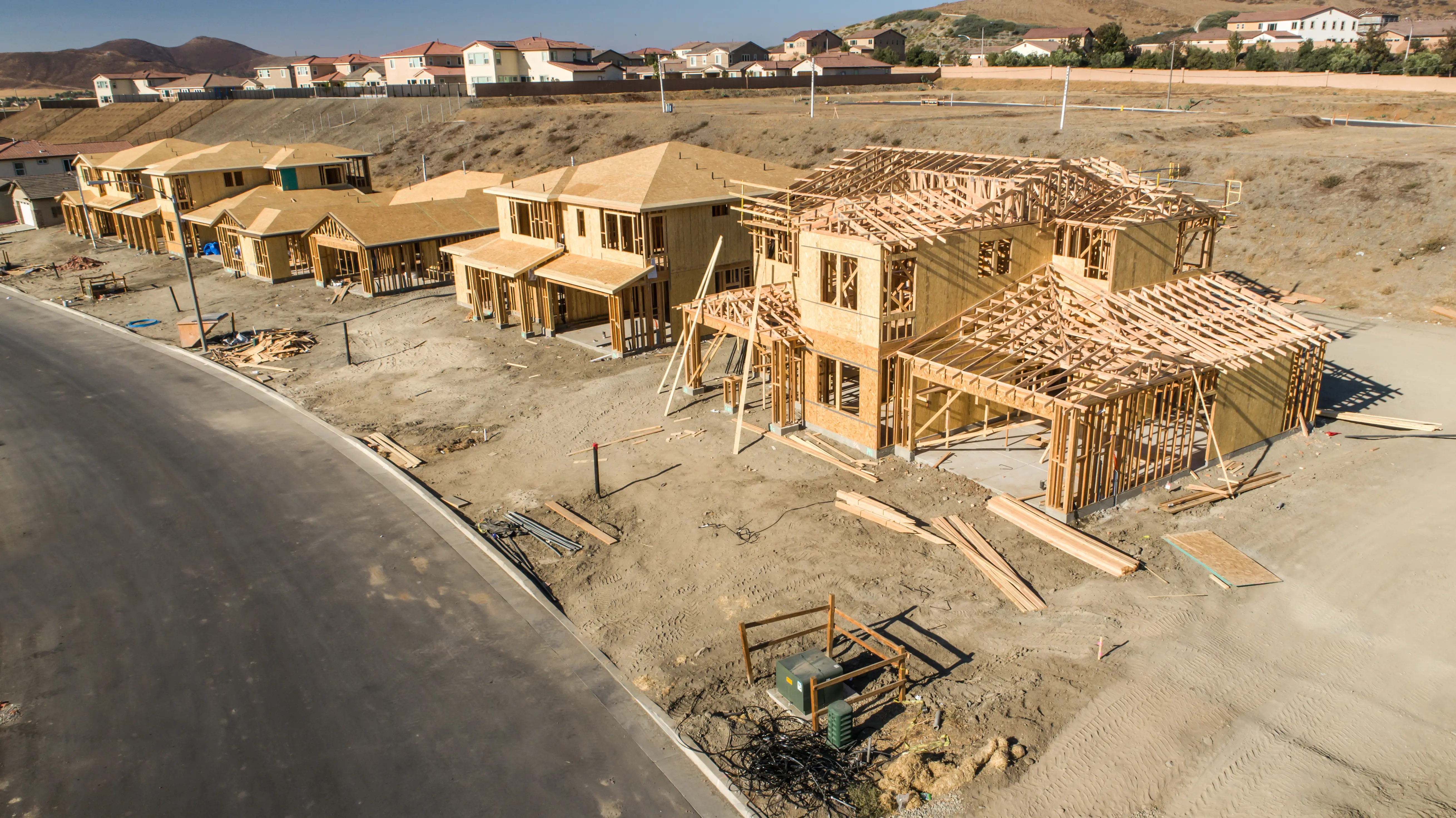
Service Gallery
Field photos, survey plans, and technical captures from our projects.