
Furry Creek Land Surveying Hub
BCLS-certified land surveying in Furry Creek, BC — boundary surveys, topographic mapping, and legal plans tailored to Squamish-Lillooet Regional District permitting requirements.
Professional Land Surveying in Furry Creek, BC
Tantalus Geomatics provides comprehensive land surveying and geomatics services across Furry Creek and the surrounding region. Our team of British Columbia Land Surveyors (BCLS) and Professional Engineers (P.Eng.) combines deep local knowledge with state-of-the-art technology to deliver highly accurate, certified plans that streamline your municipal permit approvals and protect your property investments.
Whether you are planning a residential build, a commercial development, or a complex subdivision, we work closely with local architects, builders, and municipal planning staff to ensure full compliance with local zoning bylaws and development guidelines.
Services
Explore our professional surveying services tailored to Furry Creek.
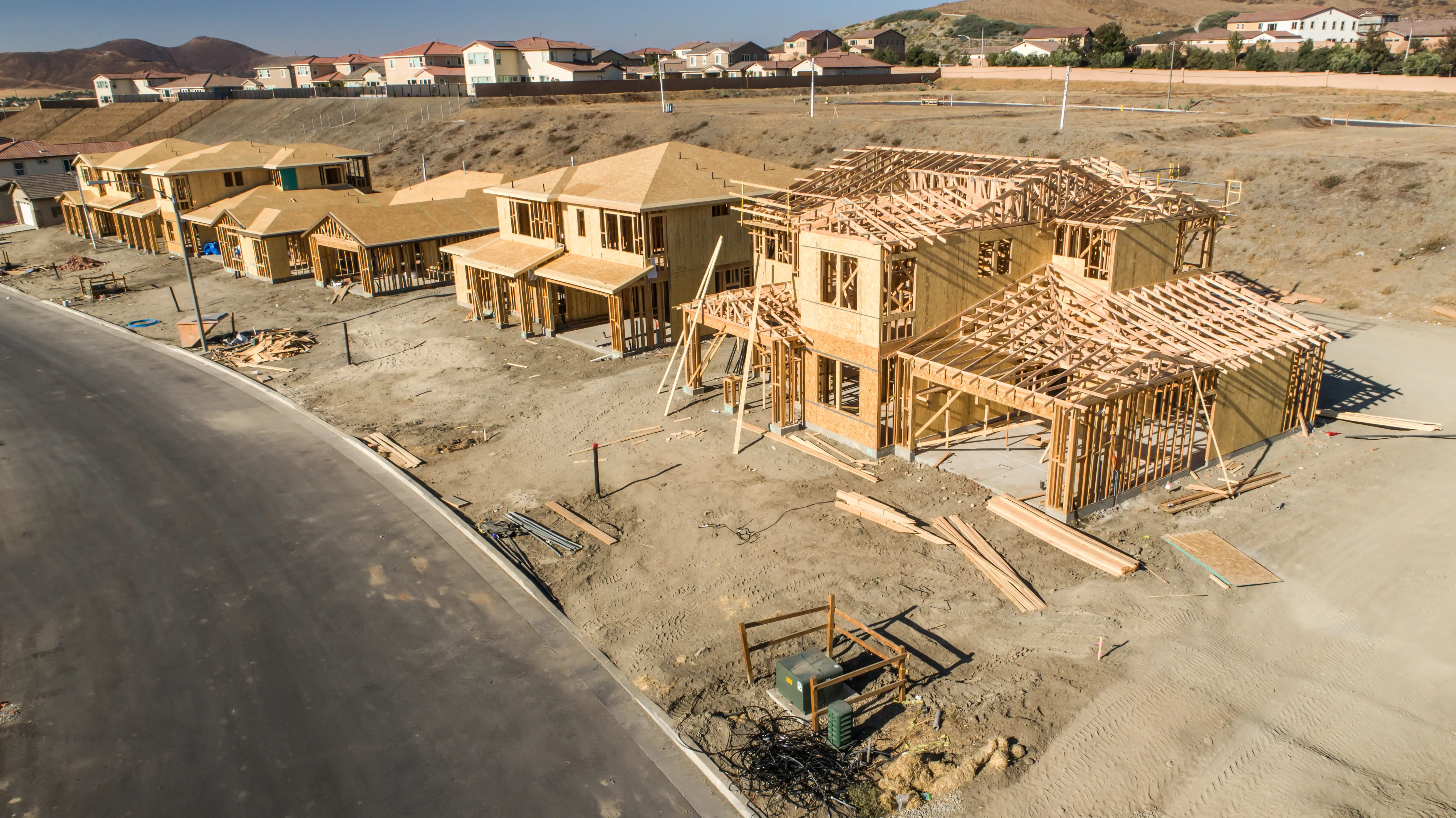
Residential Surveys
Residential surveys are typically performed for the owner of a property, or someone looking to purchase a property to facilitate improvements, additions, or renovations.
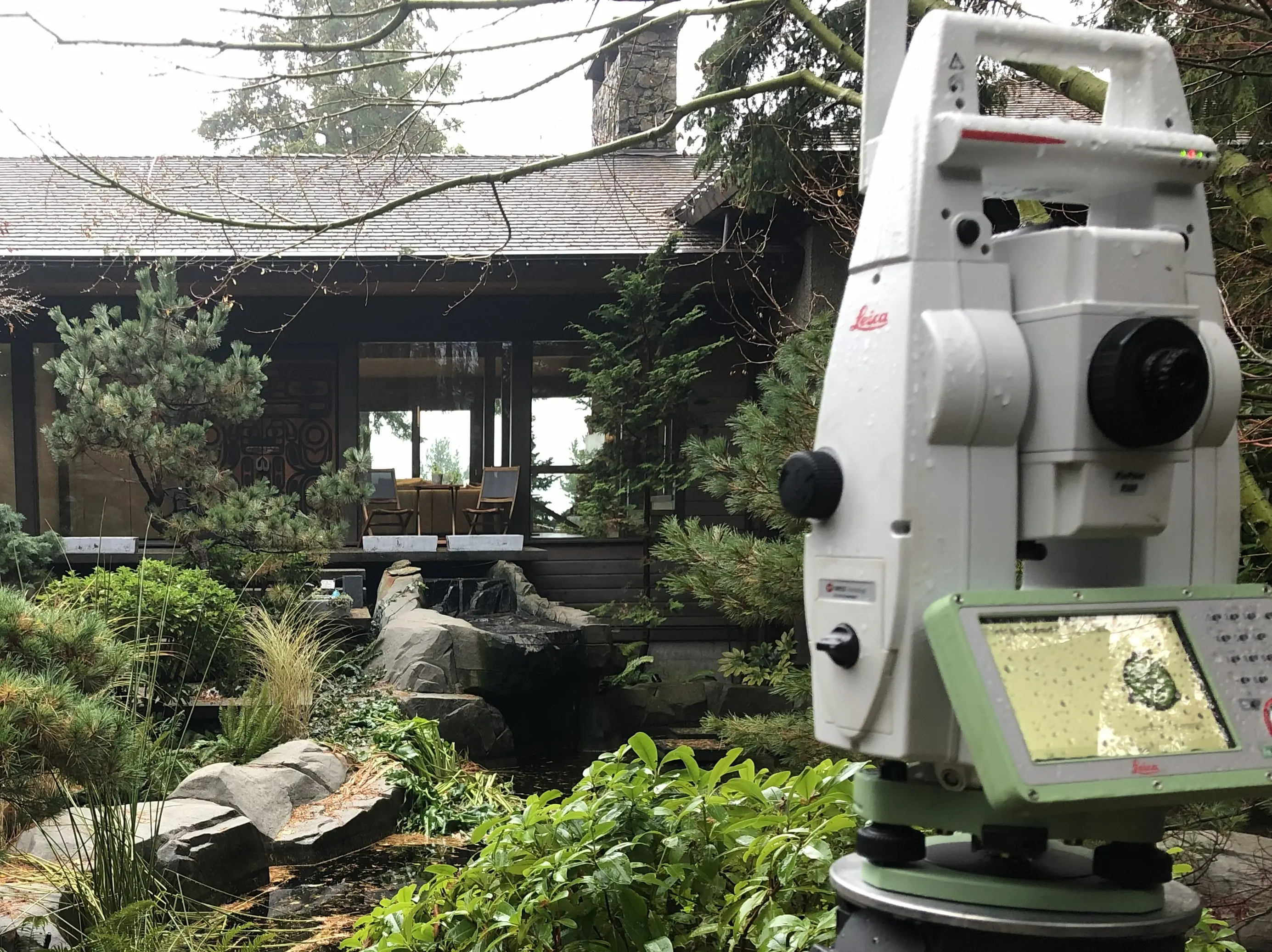
Construction Surveys
High-precision layout engineering, grading validation, and structure positioning to bridge design models with physical site deployment.
Available Services
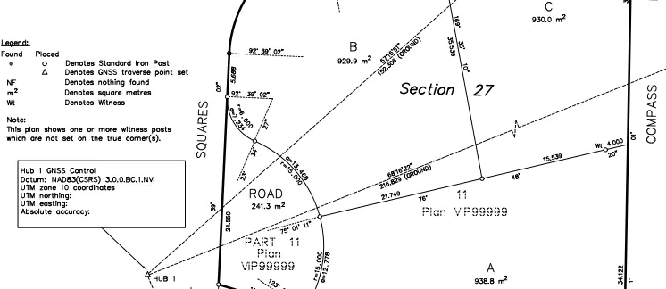
Legal Surveys
Statutory boundary re-establishments, subdivision design layout plans, and land title office registry filings overseen by a commissioned BCLS.
Available Services
Commercial Surveys
Comprehensive boundary mapping, base topographic frameworks, and title verification layouts for multi-unit, commercial, and industrial developments.
Available Services
Engineering Surveys
Millimeter-accurate tracking networks, structural deformation analysis, and settlement safety verification metrics for complex infrastructure systems.
Available Services
Strata Surveys
Comprehensive legal surveying and plan preparation for multi-unit residential, commercial, and industrial developments, ensuring clear definitions of individual titles and common property.
Available Services
Local Resources for Furry Creek
Access official municipal planning guidelines and permit checklists directly from the local authority.
View Squamish-Lillooet Regional District GuidelinesNeed Professional Assistance with Furry Creek Land Surveying Hub?
Our team of British Columbia Land Surveyors (BCLS) and Professional Engineers (P.Eng.) is ready to help guide your project to success. Contact us today for a free consultation.