Terrestrial LiDAR Scanning in the Sea to Sky
Professional Terrestrial LiDAR Scanning in the the Sea to Sky, capturing high-density digital twins and millimeter-accurate 3D point clouds of complex architectural facades, mechanical plants, and civil works.
When undertaking intricate architectural retrofits, mapping highly detailed heritage facades, or analyzing complex infrastructure in the Sea to Sky, conventional surveying methods may lack the density and speed required to capture the complete physical reality of your site. Terrestrial LiDAR (3D laser scanning) is a revolutionary geomatics technology that captures hundreds of thousands of high-precision measurements per second, generating a accurate, colorized 3D point cloud of the as-built environment. However, when this cutting-edge technology is utilized to determine the location of any natural or artificial feature relative to a legal property boundary for the purpose of certifying it in writing, it is exclusively defined as the "practice of land surveying" under the Land Surveyors Act. Relying on unlicensed scanning technicians to map your project exposes you to boundary encroachments, rejected municipal applications, and severe legal liabilities.
As a dual-registered firm of British Columbia Land Surveyors (BCLS) and Professional Engineers, we deliver the statutory authority and spatial precision required to accurately integrate your 3D scanning data with your legal property limits. Our scanning operations are strictly governed by the accuracy standards established within the Association of British Columbia Land Surveyors (ABCLS) Survey and Plan Rules, ensuring your data stands up to the most systematic engineering and legal scrutiny. We also meticulously adhere to WorkSafeBC regulations, utilizing the remote data capture capabilities of laser scanners to safely map active highways, dangerous rockfaces, and inaccessible terrain without putting personnel in harm's way.
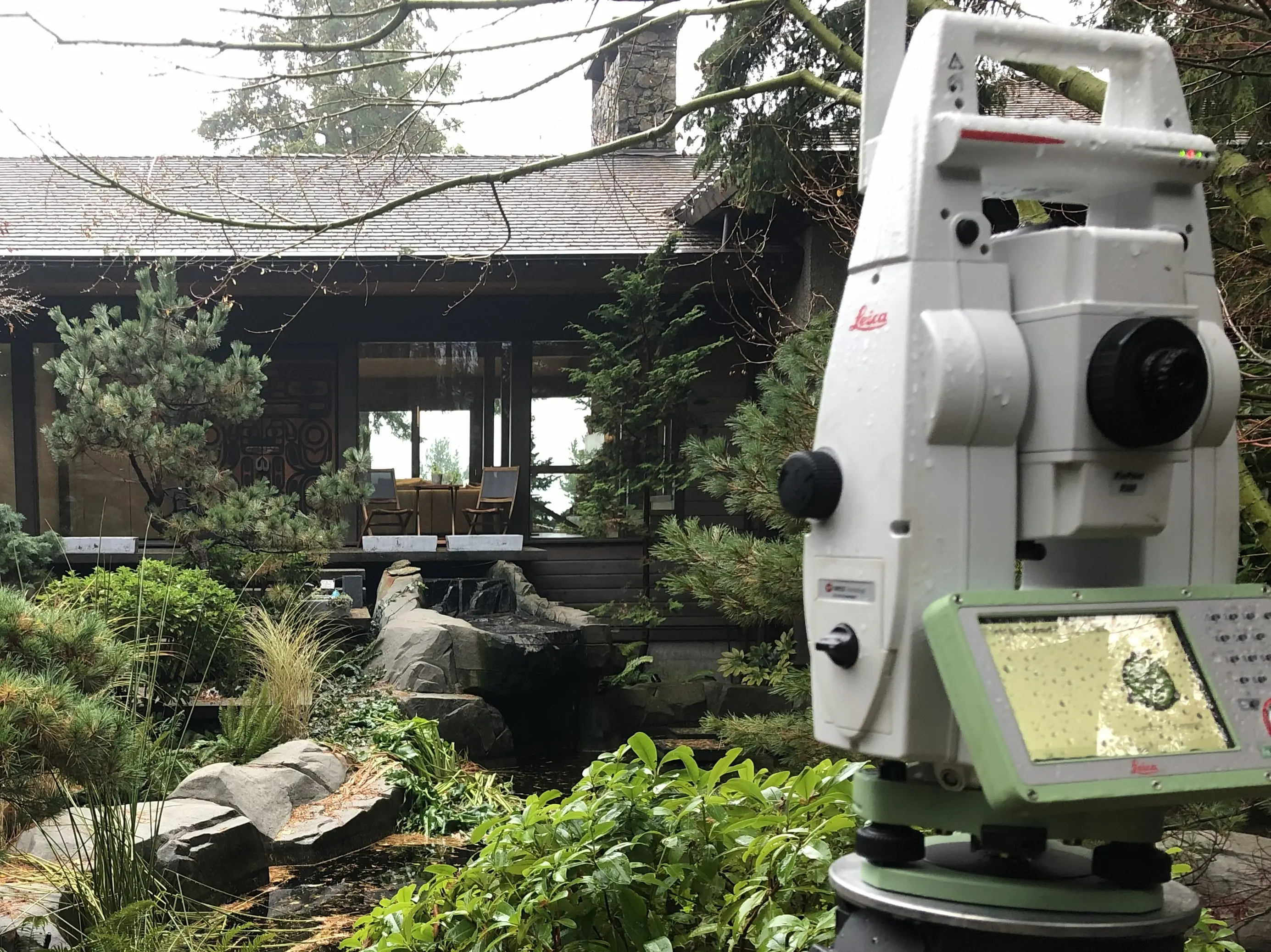
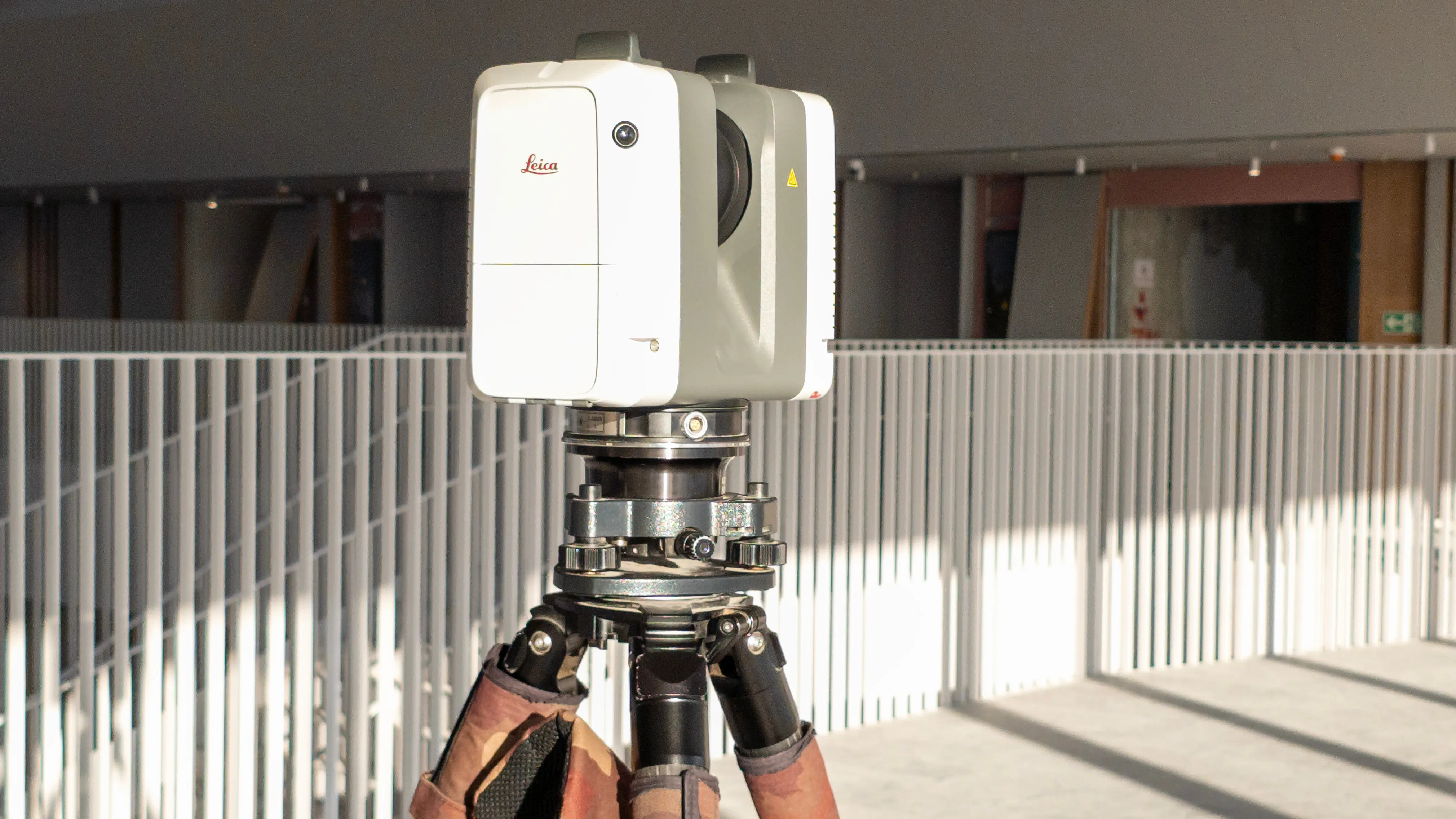
To capture this complex spatial data with high precision across the Sea to Sky, our firm deploys a state-of-the-art arsenal of geomatics equipment. We establish a primary geodetic control network by occupying points with Static GNSS and RTK GNSS Receivers to integrate your site into the project reference coordinate system. From this framework, we deploy industry leading Terrestrial LiDAR systems capable of capturing 360,000 points per second alongside full-colour panoramic images to meticulously capture the micro-details of the site.
Why Choose Tantalus Geomatics?
Our team combines local the Sea to Sky expertise with state-of-the-art surveying technology. We deliver highly accurate, BCLS-certified plans that streamline your municipal permit approvals and protect your property investments.
Other Engineering Surveys
Our Terrestrial LiDAR Scanning Process in the Sea to Sky
How do we ensure accuracy and efficiency in our land surveying projects?
Research
The foundation of a LiDAR survey is thorough documentary and site specific research. The BCLS accesses the current Certificates of Title, original Crown grants, registered subdivision plans, and historical surveyor field notes. We rigorously evaluate the parent parcel boundaries and registered encumbrances before our crews mobilize. Because LiDAR captures everything in its line of sight, understanding the context and layout of the property beforehand allows us to focus the scanning resolution precisely where the design, engineering and boundary requirements intersect.
Field Work
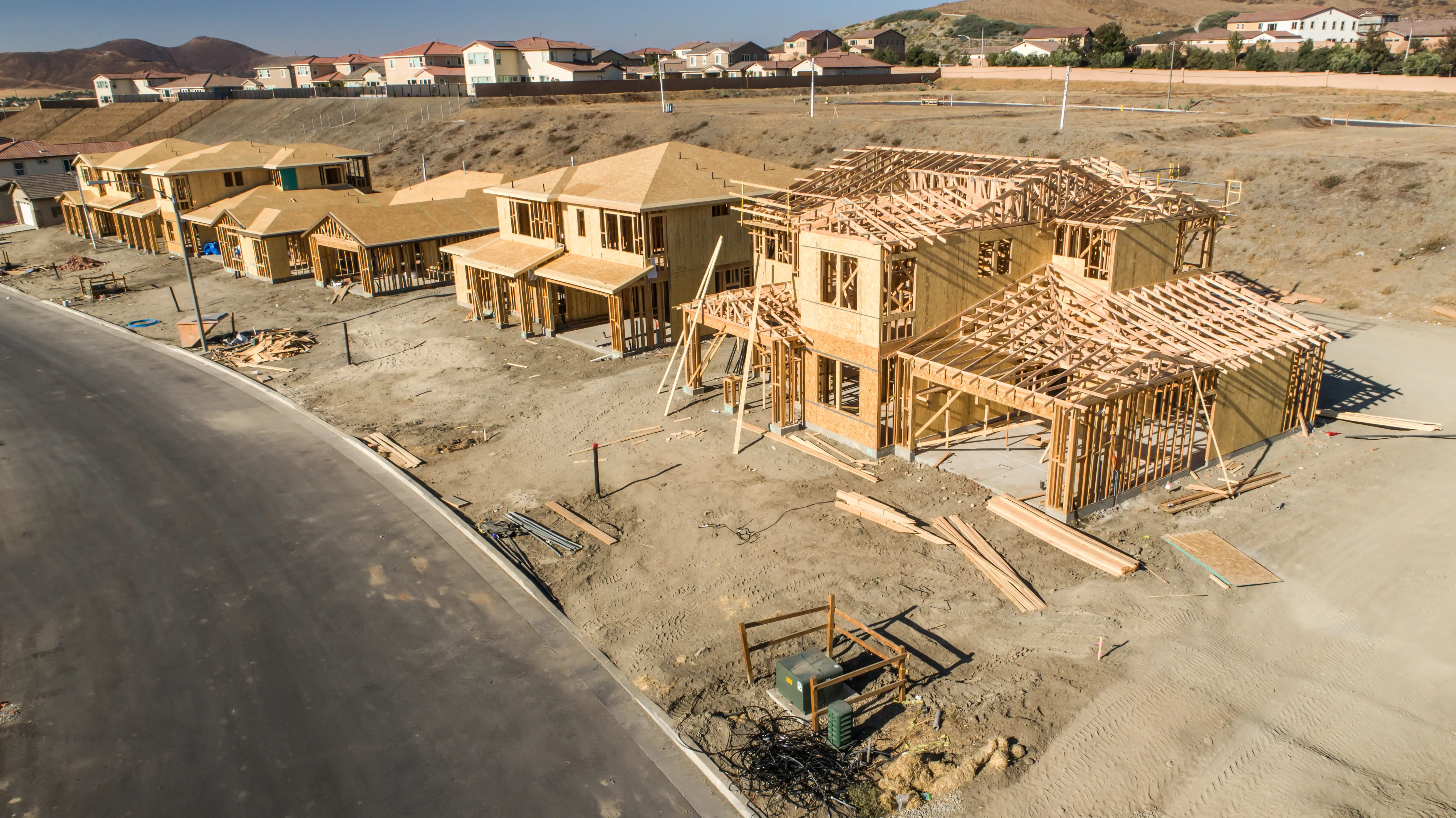
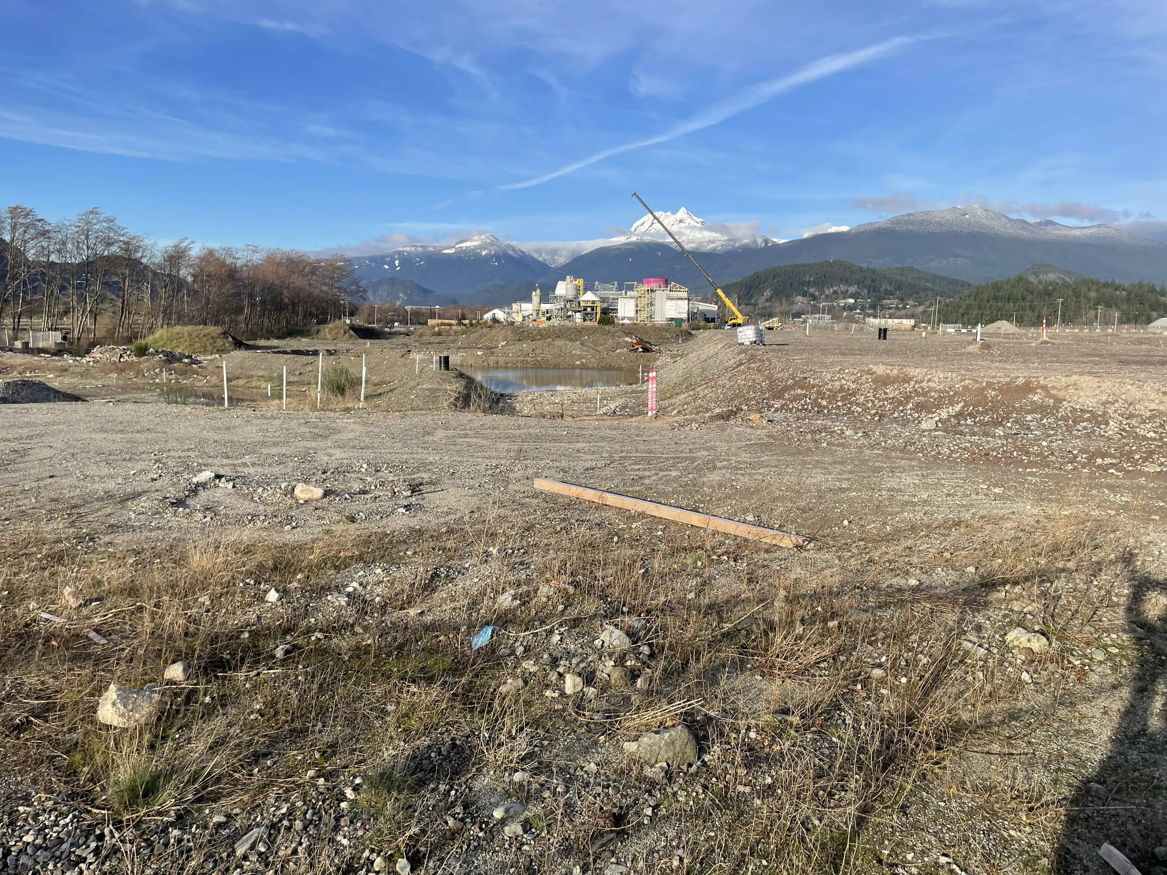
Upon arriving at your site, our survey crews must first locate and confirm the legal survey monuments to tie the scanning data to the property limits. The density of the infrastructure, the line of sight, and the required level of detail directly impact the scope of the field work, the number of scanner setups required, and the time to complete the survey. By integrating our Robotic Total Stations and GNSS equipment, we establish secure targets that geographically reference the scanner data. Our professional Terrestrial LiDAR scanners then sweep the site, collecting millions of data points across structures, retaining walls, and topography. This method provides immense safety and efficiency, as it allows us to analyze rockface geometry or busy intersections without physically occupying the danger zone.
Plan Preparation
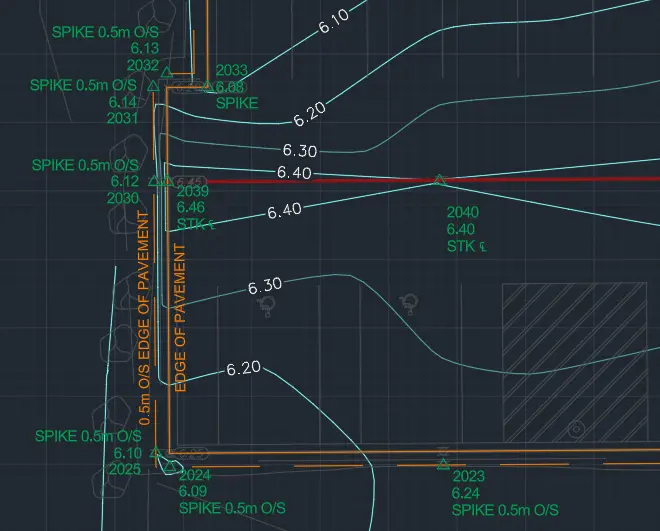
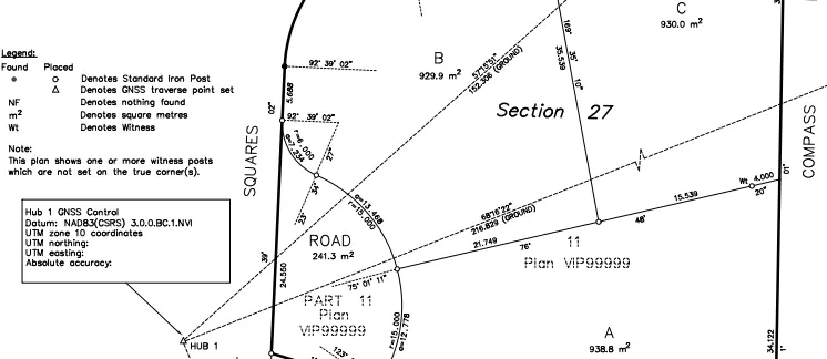
Our drafting technicians process the millions of points generated by the scanner into useable digital information. For integration into engineering software like Civil 3D, we meticulously filter the point cloud to remove non-essential points, eliminate noise, and extract critical survey figures and breaklines, keeping the surface definitions optimized. The BCLS then translates this rich 3D data into certified plans, such as a Plan of Topography, a Site Plan, or a Building Location Certificate. As your certifying professional, the BCLS electronically signs and seals the plan, taking full statutory responsibility for the spatial relationships depicted, ensuring your architects and engineers have an authoritative foundation for their designs.
What professional documents and markers do you receive upon project completion?
What professional documents and markers do you receive upon project completion?
Certified PDF Plans
Digitally signed and sealed Plans of Topography or Site Plans, accurately depicting the scanned features, structures, and contours in direct relation to your legal property boundaries.
Topographic 3D CAD Files
digital drafting files (DWG/DXF/XML) containing extracted 3D linework, breaklines, and TIN surface models for integration by your design team.
Point Clouds and Orthoimages
Formatted point cloud files (such as LAS files containing intensity and RGB colour values) and high-resolution panoramic images, providing a complete, digital model of your project site.
Clearance and Deformation Reports
Specialized geometric analysis reports utilizing the point cloud to calculate structural clearances, rockface volumes, or monitor structural settlement.
Frequently Asked Questions
Get answers to common questions about our land surveying services.
Local Resources for the Sea to Sky
Where can you find official topographic and permit checklists for the Sea to Sky?
Service Gallery
Field photos, survey plans, and technical captures from our projects.