Subdivision Surveys in City of North Vancouver
Professional Subdivision Surveys in City of North Vancouver, guiding land developers through parcel partitions, boundary adjustments, and greenfield developments from initial design up to final Land Title Office filing.
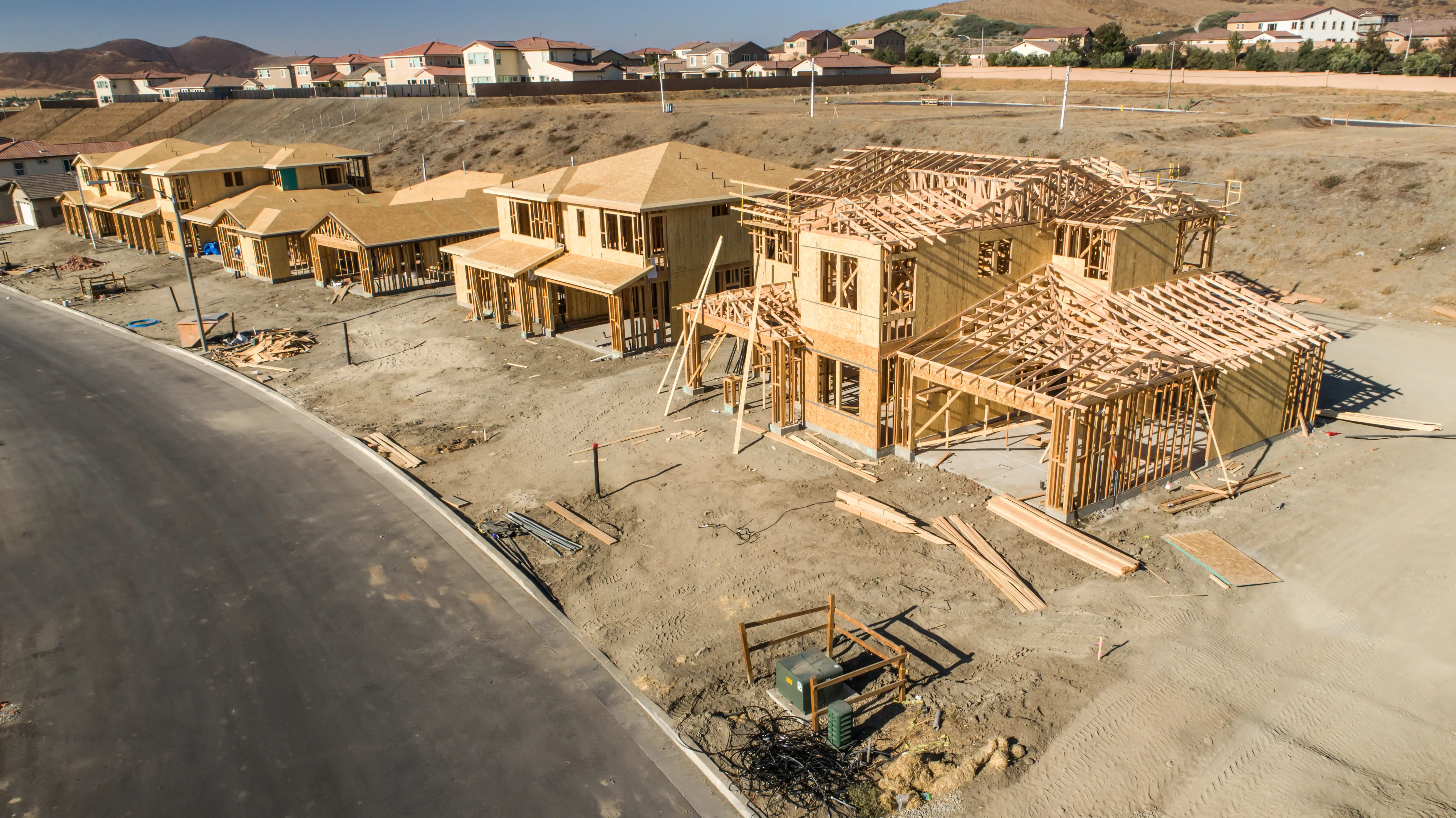
Whether you are severing a single residential lot or designing a sprawling multi-phase community in City of North Vancouver, subdividing land is one of the most powerful mechanisms for maximizing real estate value, unlocking development potential, and facilitating the transfer of property. Part 7 of the land title act is designed to ensure that municipal and regional authorities retain control over development, regulating zoning, drainage, utility supply, and local aesthetics in the public interest, while also ensuring the operation of the province's Torrens land registration system.
In British Columbia, defining the spatial and legal rights of a new parcel is an exclusive statutory function reserved strictly for commissioned members of the Association of British Columbia Land Surveyors (ABCLS). Under the Land Surveyors Act, only a BCLS holds the authority to engage in the "practice of land surveying," which includes determining, defining, and establishing boundaries in order to create new legal titles.
A successful subdivision must navigate not only the Land Title Act, but also Part 14 of the Local Government Act. Approving Officers rely on these statutes to enforce strict requirements for new subdivisions, including the provision of works and services (such as water, sewage, and drainage systems), the mandatory dedication of up to 5% of the land for park purposes, and minimum highway frontage regulations.
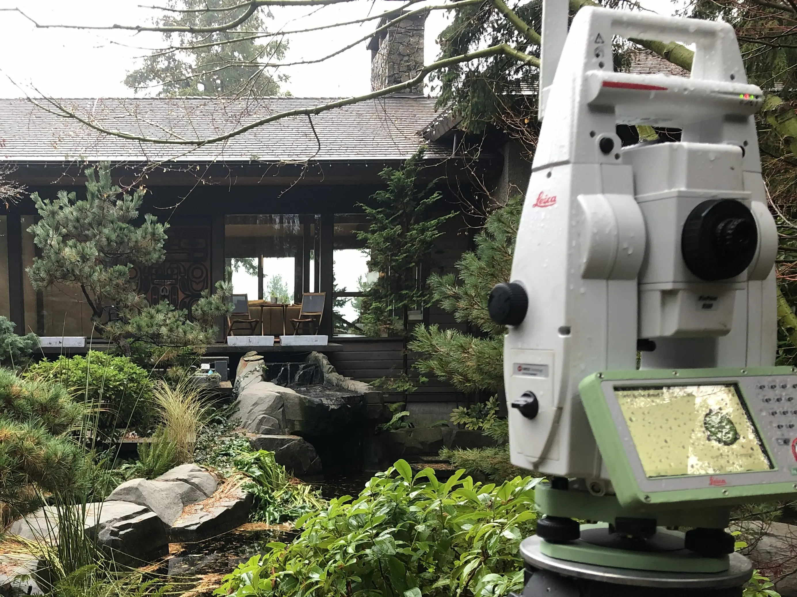
To meet the absolute and relative accuracy standards mandated by the ABCLS Survey and Plan Rules, we deploy a highly advanced suite of surveying equipment. During the initial topographic and site design phases, we may utilize Aerial Drone Photogrammetry and Aerial Drone LiDAR to penetrate dense vegetation and capture high-resolution 3D terrain models, allowing designers to optimize lot layouts and road alignments. We establish a robust geodetic control network by occupying points with Static GNSS Receivers, integrating the site into the official horizontal and vertical datums. For the precise placement of physical property corners, our crews use RTK GNSS measurements in open-sky environments, and high-precision Robotic Total Stations to run redundant closed-loop traverses in dense urban corridors or under heavy timber. Where complex adjacent infrastructure or architectural features must be preserved, Terrestrial LiDAR (3D laser scanning) is utilized to generate a accurate as-built point cloud, guaranteeing zero spatial conflicts.
Why Choose Tantalus Geomatics?
Our team combines local City of North Vancouver expertise with state-of-the-art surveying technology. We deliver highly accurate, BCLS-certified plans that streamline your municipal permit approvals and protect your property investments.
Our Subdivision Surveys Process in City of North Vancouver
How do we ensure accuracy and efficiency in our land surveying projects?
Research
The foundation of any legal subdivision is documentary research. The BC Land Surveyor gathers historical plans, field notes, Crown grants, and active title records from the Land Title and Survey Authority of British Columbia (LTSA). We also review all registered encumbrances, such as statutory rights of way and restrictive covenants, to ensure your proposed subdivision design accommodates existing legal constraints.
Field Work
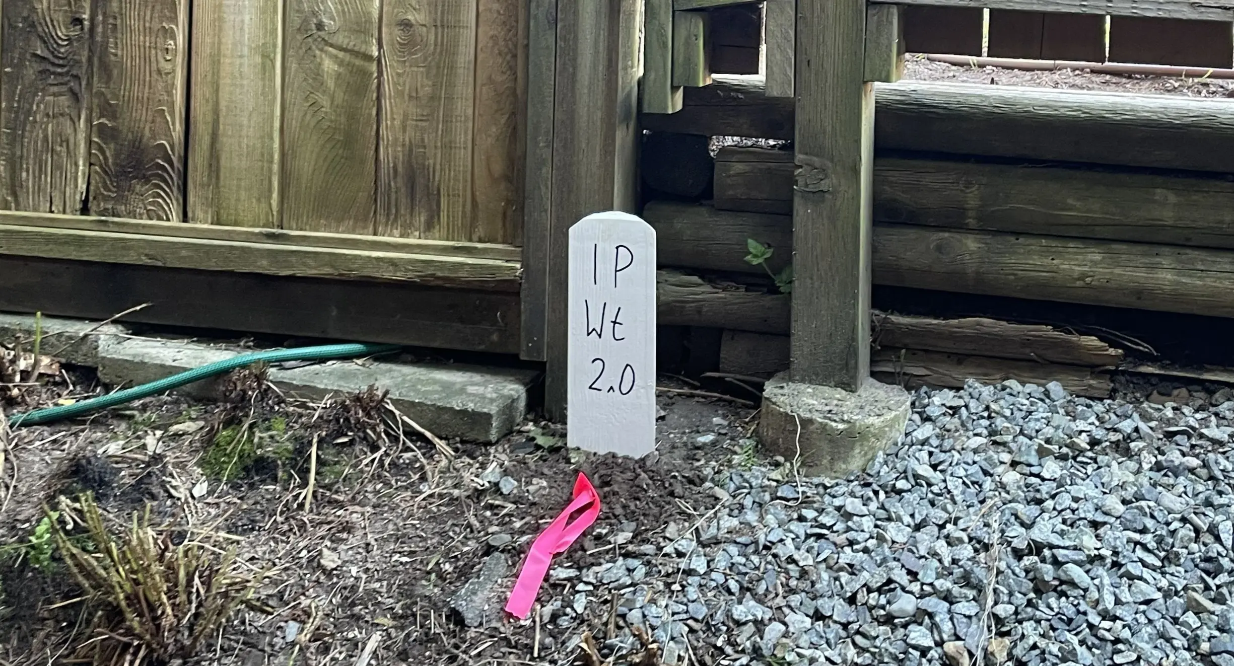
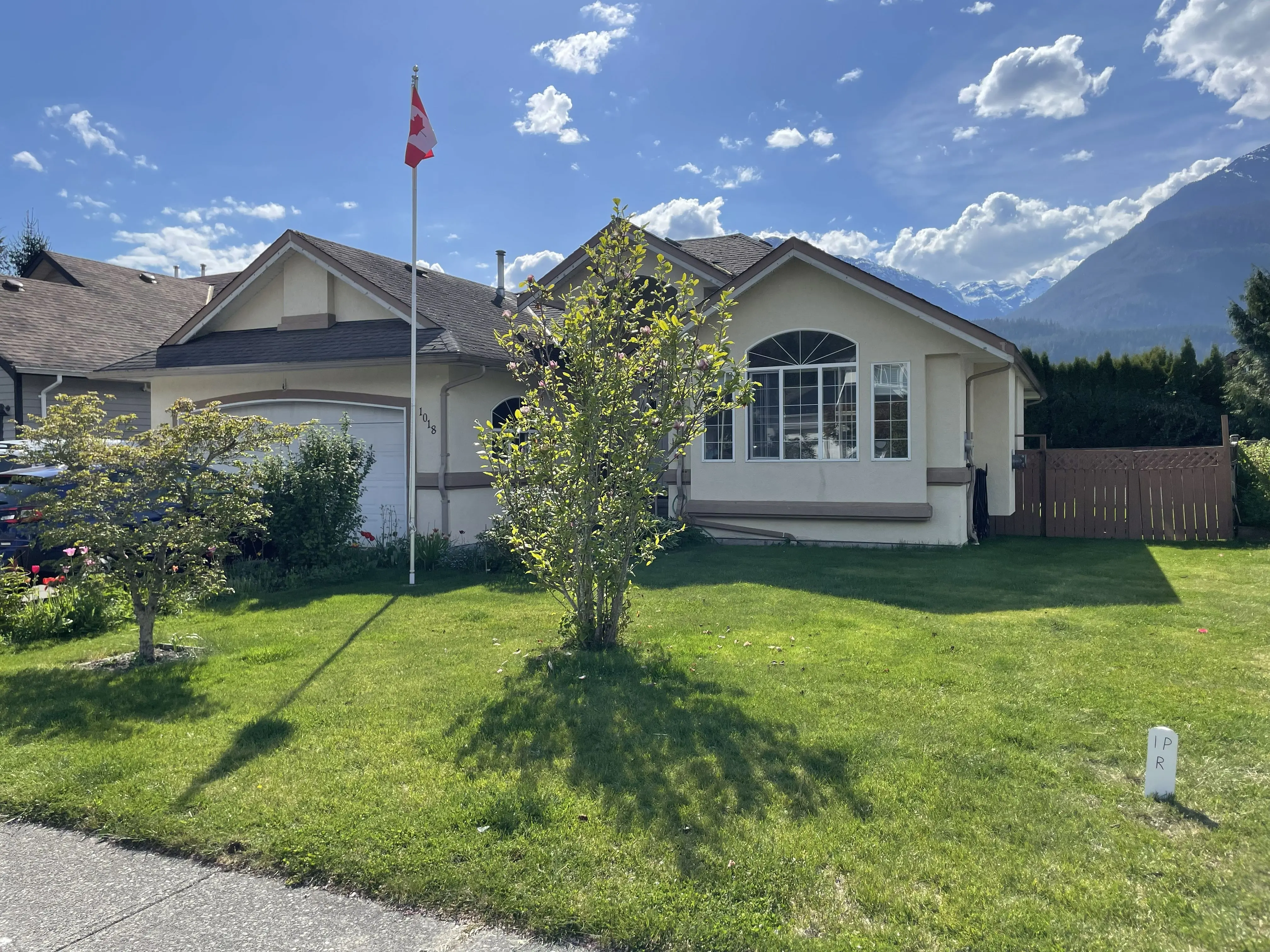
Before new lots can be created, the parent parcel must be rigorously re-established. Our field crews conduct searches to recover original survey monuments (such as standard iron posts and lead plugs) and ancillary evidence like bearing trees. Because the condition of survey fabric, terrain ruggedness, and vegetation density can vary wildly, these factors directly impact the scope of field work and the time required to complete the survey. Utilizing a combination of RTK GNSS and Robotic Total Stations, we capture the physical evidence and apply the common law "Hierarchy of Evidence" to legally determine the true boundaries. Once determined, we install standard Type 1, 2, 4, or 5 monuments in the ground to permanently mark your new subdivision corners.
Plan Preparation
With the field evidence secured, our drafting experts prepare the formal Subdivision Plan in strict accordance with the ABCLS Survey and Plan Rules. This plan translates the physical measurements into a legally binding document that must be approved by the municipal or provincial Approving Officer. As your certifying professional, the BCLS electronically signs the Survey Plan Certification (SPC) using a secure digital certificate. The complete package, including the plan and the Application to Deposit Plan (DSPL) containing all necessary owner and municipal signatures, is submitted to the LTSA. Upon systematic examination, the Registrar deposits the plan and raises the new indefeasible titles for your subdivided lots.
What professional documents and markers do you receive upon project completion?
What professional documents and markers do you receive upon project completion?
Legal Subdivision Plan
A digitally certified statutory plan (PDF) suitable for deposit in the Land Title Register to create new indefeasible titles.
Physical Monumentation
Standard iron posts, lead plugs, or rock posts securely driven into the earth to mark the new property corners.
Topographic 3D CAD Files
digital drafting files (DWG/DXF) used by civil engineers, architects, and planners for site and infrastructure design.
Point Clouds and Orthoimages
Dense 3D laser scan data and high-resolution aerial imagery providing a complete digital twin of the project site.
Frequently Asked Questions
Get answers to common questions about our land surveying services.
Local Resources for City of North Vancouver
Where can you find official topographic and permit checklists for City of North Vancouver?
Service Gallery
Field photos, survey plans, and technical captures from our projects.