Gridline And Construction Layout Surveys in City of North Vancouver
Professional Gridline and Construction Layout Surveys in City of North Vancouver, delivering certified legal boundary definitions, advanced geomatics positioning, and professional municipal development compliance mapping.
Translating highly complex architectural and engineering designs into physical reality in City of North Vancouver requires high precision and absolute spatial certainty. Gridline layout surveys provide the fundamental geometric framework for your entire construction project, dictating the placement of foundations, columns, and structural shear walls. Because gridlines are inherently tied to your property's legal limits to ensure compliance with municipal setbacks, establishing this framework is an intensely regulated legal process. Under the Land Surveyors Act, determining the location of any artificial feature relative to a property boundary for the purpose of certifying it in writing is exclusively defined as the "practice of land surveying". Relying on unlicensed contractors to map your structural gridlines exposes your development to significant risks, including boundary encroachments and halted construction. Only a commissioned British Columbia Land Surveyor (BCLS) holds the statutory authority and professional liability insurance to legally position these critical features relative to property boundaries.

As a dual-registered firm of British Columbia Land Surveyors and Professional Engineers, our team delivers the authoritative foresight required to accurately execute your gridline layout. During the layout process, we mandate that all critical reference points the markers your contractor will use to re-establish building corners and structural lines are double-checked to guarantee accuracy. We also establish redundant horizontal and vertical control points, including the extension of existing lines and backsights on stable walls, ensuring your project has a reliable framework even when active construction destroys temporary survey markers.
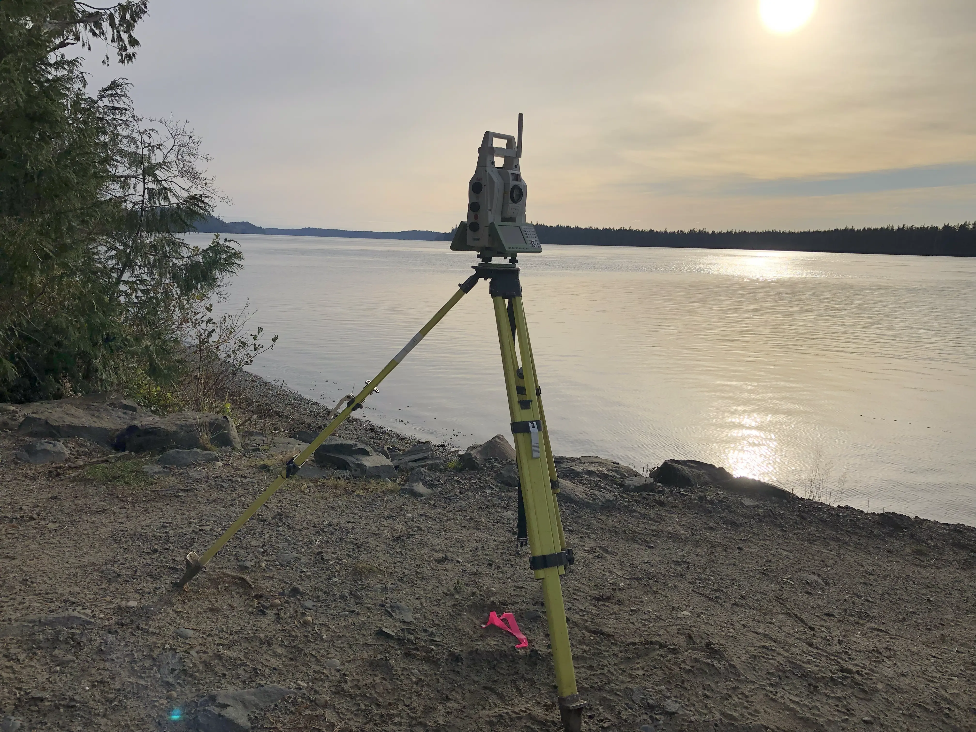
To achieve the absolute and relative accuracy standards demanded by your design team, our firm deploys state-of-the-art geomatics equipment. During preliminary site assessments, we utilize Aerial Drone Photogrammetry and Aerial Drone LiDAR to generate accurate 3D topographic models of the pre-construction environment. To anchor the project's spatial framework, we deploy Static GNSS and RTK GNSS Receivers to integrate your property into the project's coordinate reference system. However, because deep excavations and dense urban environments frequently obstruct satellite signals, our survey crews leverage high-precision Robotic Total Stations to physically establish your gridlines and run closed-loop traverses. If your site features complex existing infrastructure or heritage facades, Terrestrial LiDAR (3D laser scanning) is utilized to capture a high-density point cloud of the as-built conditions, guaranteeing that our layout accurately accommodates the physical reality of your site in City of North Vancouver.
Why Choose Tantalus Geomatics?
Our team combines local City of North Vancouver expertise with state-of-the-art surveying technology. We deliver highly accurate, BCLS-certified plans that streamline your municipal permit approvals and protect your property investments.
Our Gridline And Construction Layout Surveys Process in City of North Vancouver
How do we ensure accuracy and efficiency in our land surveying projects?
Research and Pre-Calculation
The foundation of a gridline or construction layout is documentary research and careful review of proposed designs. The BCLS requires the complete set of architectural and engineering drawings explicitly marked "Issued for Construction" or "Approved for Construction" in advance of our field deployment. By securing the CAD drawings early, our experts pre-compute the layout to identify plan misclosures or dimensional discrepancies, resolving them with your design team before construction begins. Furthermore, we conduct systematic research through the Land Title and Survey Authority of British Columbia (LTSA) to define the parent parcel boundaries.
Field Work
Upon arriving at your site, the BCLS must first locate and confirm that sufficient legal survey monuments are in place. Conducting a boundary-sensitive construction layout near unposted property boundaries incurs massive professional and financial liabilities; therefore, we recommend that missing property corners be formally posted prior to construction layout or establishing the gridlines. The scope of the field work and the time required to complete the survey are directly impacted by the density of construction activity and existing infrastructure. Utilizing Robotic Total Stations, we precisely establish your structural gridlines, offset stakes, and reference points.
Plan Preparation
Following the precise field layout, our drafting technicians translate the dense 3D field data into a formal Certificate of Location of Layout for Construction. This vital non-statutory document explicitly details the points set, their offsets, and, if applicable, their vertical elevations. As your certifying professional, the BCLS takes full statutory responsibility for the layout, electronically signing the certificate. This document serves as the authoritative, written guarantee for your municipal building inspectors and structural engineers that the gridlines conform accurately to both your approved design and your legal property boundaries.
What professional documents and markers do you receive upon project completion?
What professional documents and markers do you receive upon project completion?
Certified PDF Plans
A digitally signed and sealed BCLS Certificate of Location of Layout for Construction, explicitly detailing the gridline points set, their offsets, and elevations.
Property Corner and Layout Monumentation
The physical installation of robust reference points, offset hubs, control monuments, and intersection stakes to guide your contractors.
Topographic 3D CAD Files
digital drafting files (DWG/DXF) mapping the exact layout points, legal property boundaries, and site topography for integration by your architects and engineers.
Point Clouds and Orthoimages
Dense 3D Terrestrial LiDAR scan data and high-resolution aerial imagery providing a complete digital twin of the construction site.
Frequently Asked Questions
Get answers to common questions about our land surveying services.
Local Resources for City of North Vancouver
Where can you find official topographic and permit checklists for City of North Vancouver?
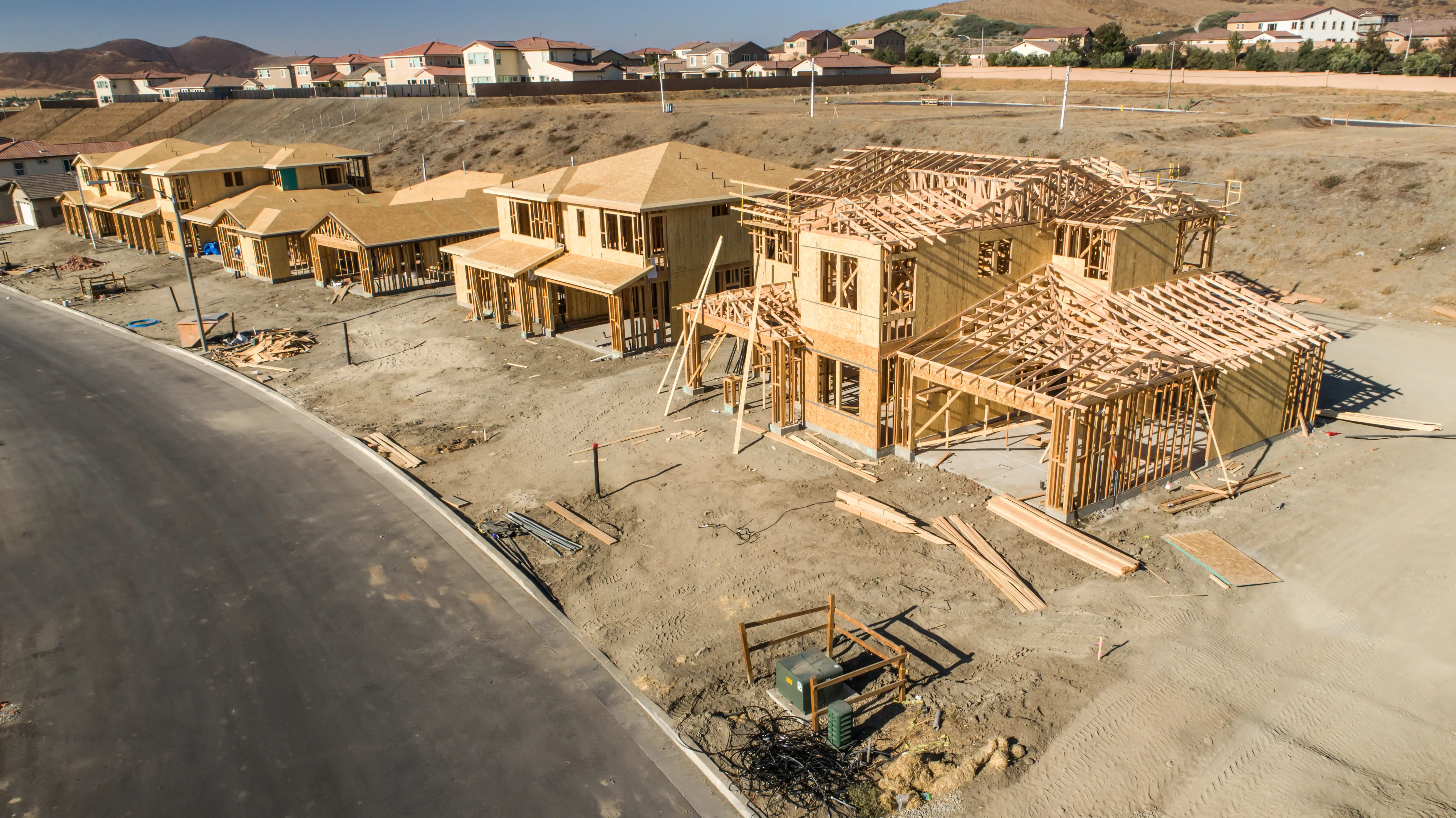
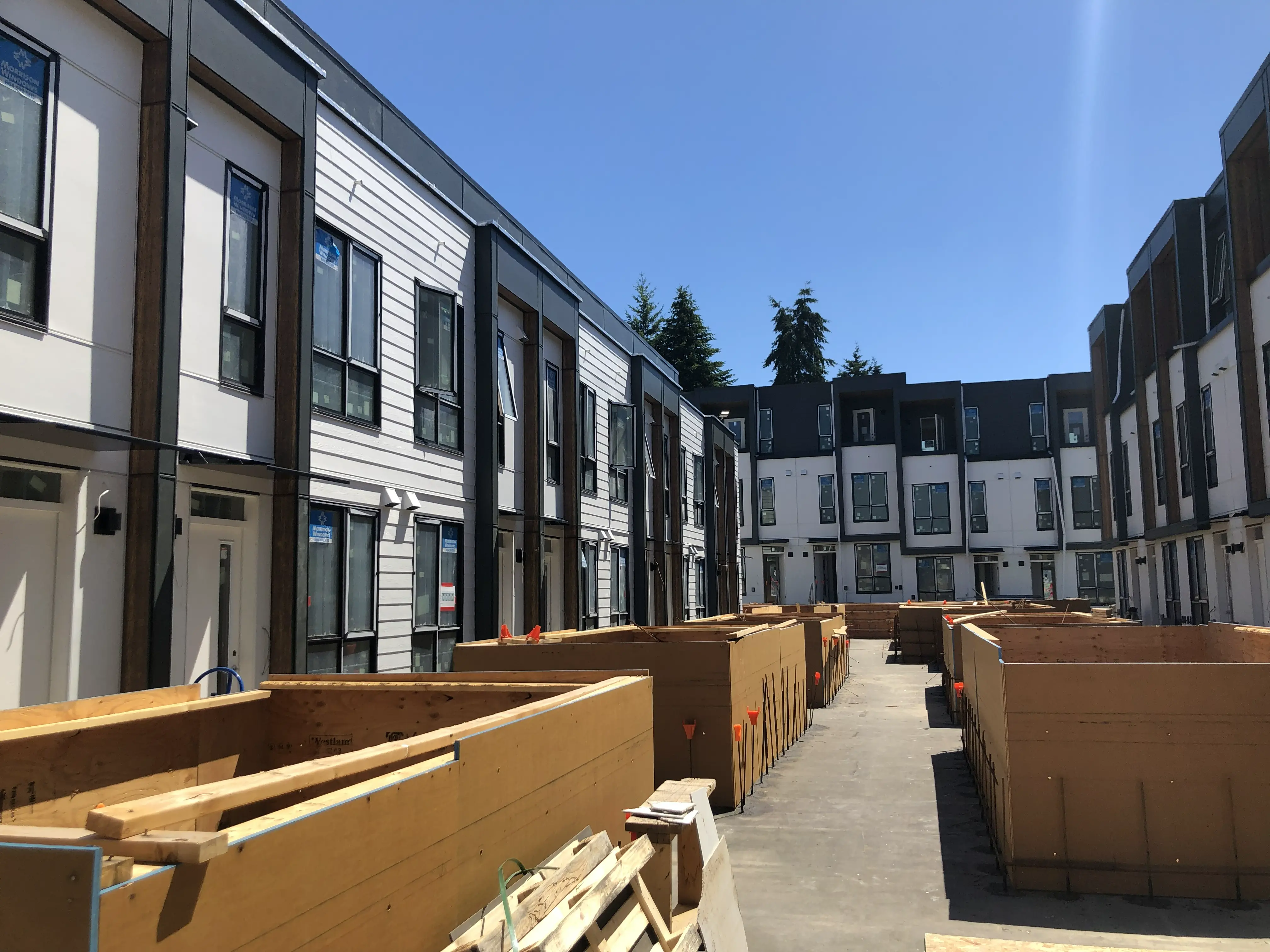
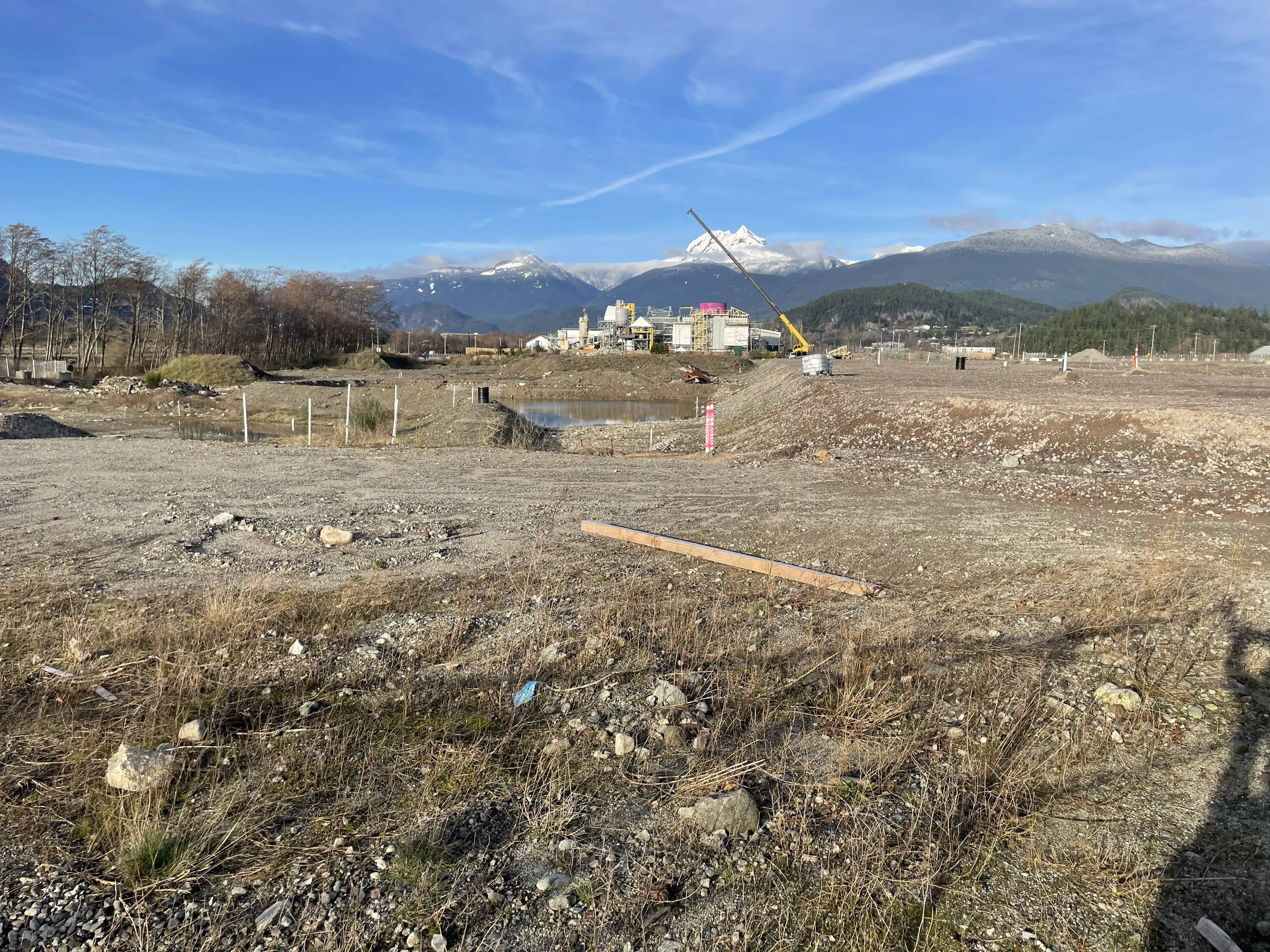
Service Gallery
Field photos, survey plans, and technical captures from our projects.